Blog

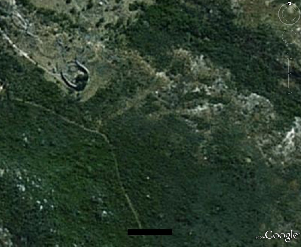
When on Google Earth 37

HINT: It might be an Antipadean site….

As Billy solved When on Google Earth 36 (WhenonGE) at Ferhans Blog (site not located in his garden this time), we are delighted to present WhenonGE 37…

Q: What is When on Google Earth? A: It’s a game for archaeologists, or anybody else willing to have a go!

Q: How do you play it? A: Simple, you try to identify the site in the picture.

Q: Who wins? A: The first person to correctly identify the site, including its major period of occupation, wins the game.

Q: What does the winner get? A: The winner gets bragging rights and the chance to host the next When on Google Earth on his/her own blog!

Be the first to correctly identify the site below and its major period of occupation in the comments below and you can host your own!

WhenonGE 37

WoGE so far:

#

Host:

Victor:

Site:

Period:

1

Shawn Graham

Chuck Jones

Takht-i Jamshid / Persepolis terrace, Iran

Achaemenid period

2

Chuck Jones

PDD

Church of Saint Simeon at Qalat Siman, Syria

5th-6th c. CE

2.1

Chuck Jones

Paul Zimmerman

Qal’at al-Bahrain

16th c. CE

3

Paul Zimmerman

Heather Baker

Baraqish (Yathill), Yemen

Minaean

4

Heather Baker

Jason Ur

Mohenjo Daro,

ca. 2600-1900 BCE

5

Jason Ur

Dan Diffendale

Monte Albán, Oaxaca, Mexico

1st-5th centuries CE

6

Dan Diffendale

Claire of Geevor Mine

Segontium, Caernarfon, Wales

77ish to about 390 CE

7

Claire of Geevor Mine

Ivan Cangemi

Carn Euny

ca. 500 BCE-100 CE

8

Ivan Cangemi

Southie Sham

Monks Mound (Cahokia), IL, USA

fl. 1050-1200

9

Southie Sham

Dan Diffendale

Gergovia

fl. 1st c. BCE

10

Dan Diffendale

Dorothy King

Kastro Larissa/Argos, Greece

ca. 1100 CE

11

Dorothy King

Daniel Pett

Utica, Tunisia

8th century BCE–until 2nd Century CE

12

Daniel Pett

Neil Silberman

Caesarea Maritima, Israel

1st century CE–Present

13

Neil Silberman

Chuck Jones

Graceland, Memphis, TN, United States

1939 CE–Present

14

Chuck Jones

Aphaia

Bam Citadel, Iran

pre-6th century BC–19th century CE

15

Aphaia

Daniel Pett

Myrina, Lemnos, Greece

Classical Greek–present

16

Daniel Pett

Paul Barford

Dambulla Cave Temple, Sri Lanka

1st century BCE

17

Paul Barford

Scott McDonough

Rosetta (Rashid), Egypt

Ptolemaic, Mamluk

18

Scott McDonough

Lindsay Allen

Ani, Turkey

Medieval, 10th-14th centuries CE

19

Lindsay Allen

Heather in Vienna

South Shields, England, UK

Roman Imperial

20

Heather in Vienna

Scott McDonough

Suomenlinna/Sveaborg fortress, Helsinki, Finland

1748-present

21

Scott McDonough

Chuck Jones

Derbent, Republic of Dagestan

Sasanian-present

22

Chuck Jones

Paul Barford

Amphitheatre of Aquincum (Budapest), Hungary

Roman

23

Paul Barford

Geoff Carter

The Cursus, (Stonehenge) Wiltshire

Neolithic

24

Geoff Carter

Ferhan Sakal

The Heuneburg, South Germany

Iron Age

25

Ferhan Sakal

Lindsay Allen

Sura, Syria

Roman

26

Lindsay Allen

Andrea

Bannerman Castle, Hudson River, US

C20th

27

Andrea

David Powell

Taposiris Magna, Alexandria, Egypt

C1st bce

28

David Powell

Billy

Ross Abbey, Galway, Ireland

Medieval

29

Billy

Geoff Carter

Great Zimbabwe, Africa

C11th – 14th ce

30

Geoff Carter

Heather

Elsdon Castle, England

C11th – 12th ce

31

Heather

Geoff Carter

Volubilis, Morocco

Roman

32

Geoff Carter

Paul Barford

Su Nuraxi, Barumini, Sardinia

C15th – 6th bce

33

Paul Barford

Ferhan Sakal

Arkona, Germany

Medieval

34

Ferhan Sakal

Heather

Arslantepe, Turkey

Chalcolithic – Byzantine

35

Heather

Ferhan Sakal

Mahabodhi Temple Complex, India

3rd century B.C. – 6th CE

36

Ferhan Saka

Billy

Borobudur, Buddhist shrine,  Central Java

9th  century B.C. – 6th CE

Drumaskibbole Fulacht Part 2

Author of original report and Site Director: Tom Rogers

During Construction works for the realignment of the R284 from Drumaskibbole to Ballygawley in County Sligo, Tom Rogers of Moore Group excavated a fulacht fiadh and two stone trackways (along with a number of assorted other features). This is part 2 of a 2 part post on the Drumaskibbole site. Part 1 is here.

The excavation was commissioned and funded by Sligo County Council.

All remaining overlying peat was removed from the area of excavation by hand except for a small area where the original ground surface remained. Here a core sample was taken and the contexts recorded. These were as follows; C1 was topsoil and sod, a peaty brown soil with some clay elements held together by fine grass roots. Beneath this C2 was a 0.13m layer of soft grey clay with bright mottling from organic inclusions and some black phragmites fragments. Below this C3 was a well humified peat layer containing sphagnum and phragmites fragments and frequent roots. This context covered most of the site and was variable in depth gradually thinning to the south as the natural sands (C26 and C24) rose to the south. The site was cleaned, photographed and recorded.

During the monitoring phase, some areas of peat close to the fulacht but outside the fenced off area were left to be removed during the excavation phase. These areas were carefully stripped by machine using a toothless grading bucket. Some 10m to the west of the original stone feature on the north side of test trench 4 from the monitoring phase, a second line of stones was uncovered. This was cleaned and recorded, and incorporated into the excavation area.

The site pre-excavation thus comprised the burnt mound, with a wooden trough at the summit, generally dipping gently to the north and disappearing beneath a layer of peat on which two roughly parallel linear stone features were set.
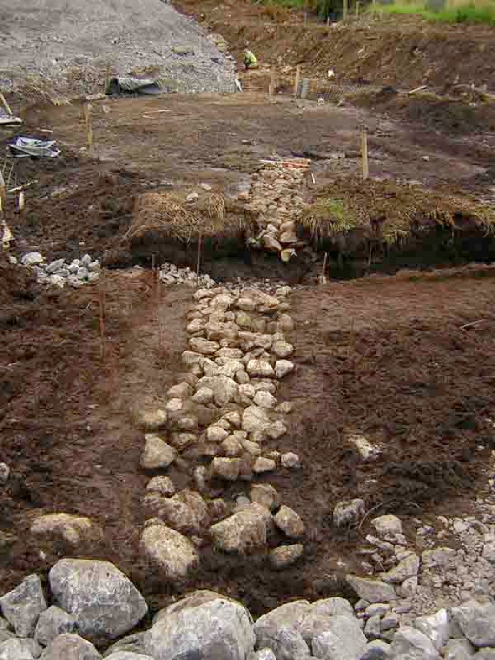
stone-feature-1 The eastern stone feature, C5

C5 was the eastern of the two stone features at the northern edge of the site. It comprised a band of rounded stones composed of a white to creamy banded metamorphic rock, probably schist. The feature was between 0.9m and 1.05m wide, running a total length of 14.9m. It was set into C8, a peat similar to C3 but less homogenous, with frequent lenses of sand running through, which lay directly over the burnt fulacht material (C6).

In section the cut of the stone feature (C10) was a shallow ‘U’ shape and cut both the peat C8 and C9, a very compact and fine sand comprised largely of quartz and mica which gave it a light brown to grey colour, at the base. The ‘U’ shape and the use of a hard base material led to the conclusion that this was a path deliberately built into the firm sand to allow passage across the bog.  A single peg with a worked end was found lying on top of the path (find 1).

The western stone feature

This feature lay 5.7m to the west of C5 and some 0.1m-0.15m below. It was also a line of stones, similar in nature and orientation to C5 although the stones were slightly smaller, a maximum of 0.2m in either dimension. At its widest point the feature was 1m and at its narrowest, 0.7m. The surviving section however was considerably shorter than C5, only remaining on the northern side of test trench 4 for a length of 2.5m. Again the section showed a shallow ‘U’ shaped profile to the stones and the base of the cut (C14) was again more solid than the peat although this time it was another lens of material within the C8 (the peat).

Excavation of Fulacht Fiadh

Methodology; the burnt mound was cleaned and recorded, then divided into four quadrants, centred a point slightly to the south west of the visible wooden trough (trough 1, C21).The quadrant sections were removed one by one and the resulting profiles through the mound drawn.

After the recording and removal of the two stone pathways and the natural deposits below, (C8 and C9 the peat and interbedded sand) it became clear that the burnt mound (largely C6) extended some way beneath the former line of the pathways.  At the very northern edge of the mound, the burnt material began to dip very sharply beneath the thickest layer of peat.

Trough 1

This trough was situated at the summit of the burnt mound, slightly off centre toward the south east. The top fill, C18 was charcoal rich, burnt and shattered stones up to 0.05m similar to C6 but also with some silty clay. Beneath this C19 was similar but with larger stones, up to 0.1m and some peat as well as less humified plant material similar to that found between the stones of the pathway.
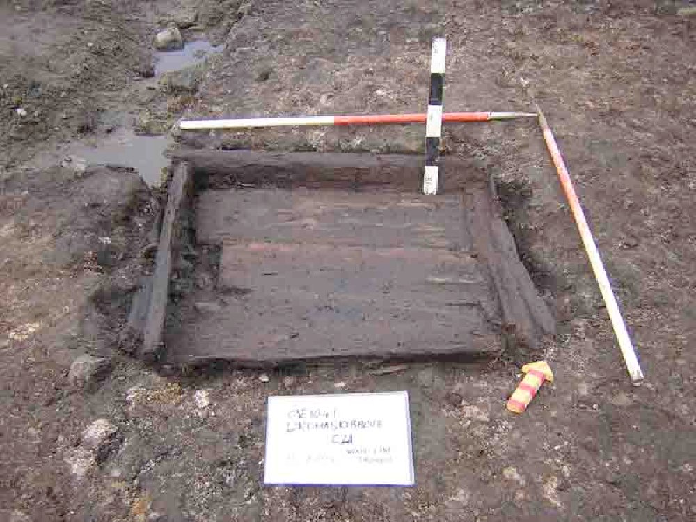
trough-1

The wood lining of the trough itself consisted of four side planks arranged in a square around three base planks orientated WSW-ESE. The western side board was propped from the outside by two other wooden pieces which may have once been a single element. The timbers in general were well preserved. No joints were evident nor were the planks tightly fitting, implying either shrinkage of the wood or the generous use of a clay lining.

The cut of the trough (C22) was sub square with generally steep sides and a flat base, only slightly larger than the trough, measuring a maximum of 1.25m from ENE-WSW and 0.97m SSE-NNW.
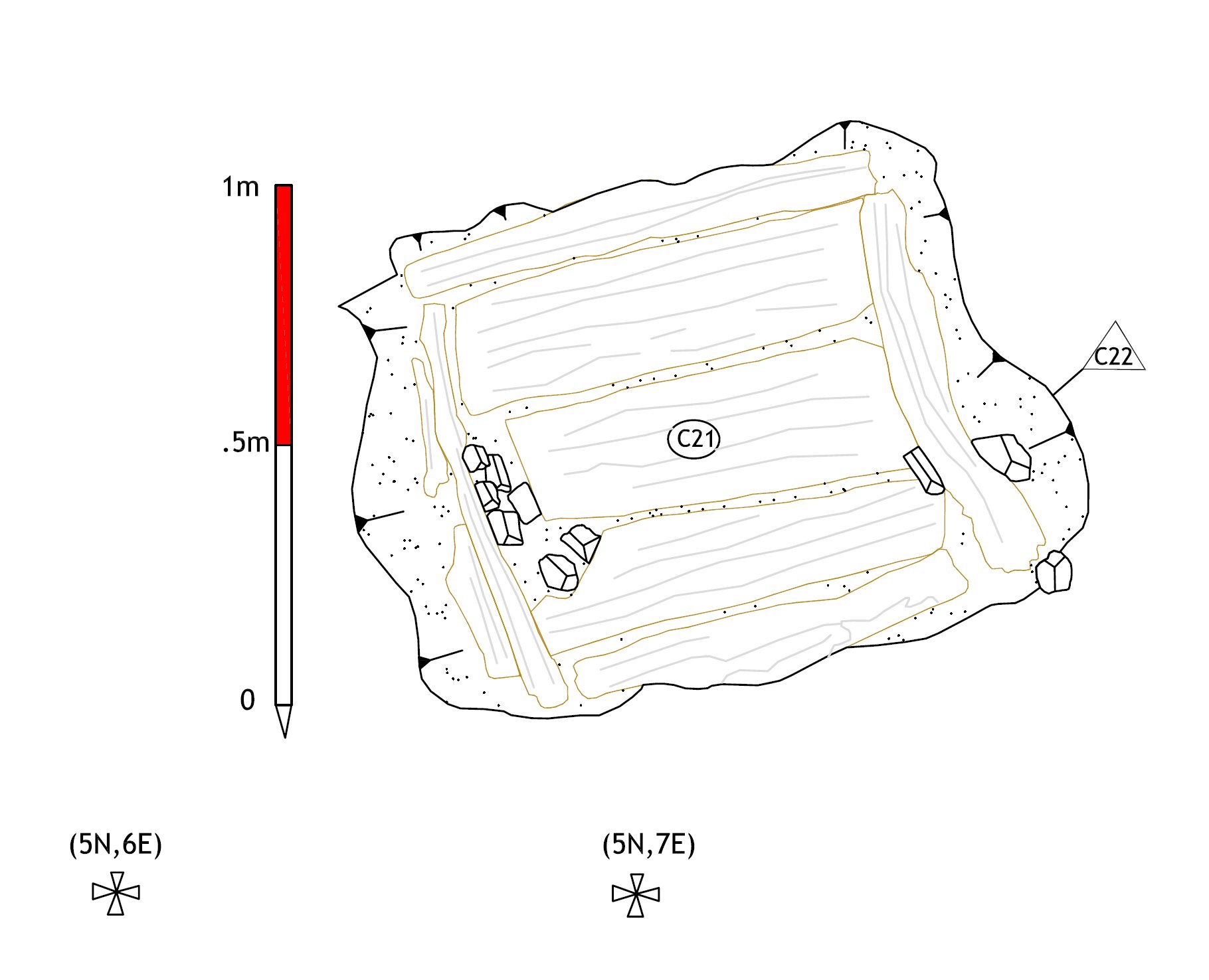
trough-11

Trough 2

The second trough to be uncovered on the site was in the south-western quadrant of the burnt mound on the southern arm of a horseshoe shape of C6 the charcoal rich fulacht material. Here a keyhole-shaped pit (cut C27) oriented roughly east west was cut into the natural white marl C26. The sides were gently sloped at the top but becoming sheer and almost vertical towards the base, except to the north where they were steeply sloped. The fill was a dark charcoal rich material of heat shattered stones and ash (C29), broadly similar to C6.
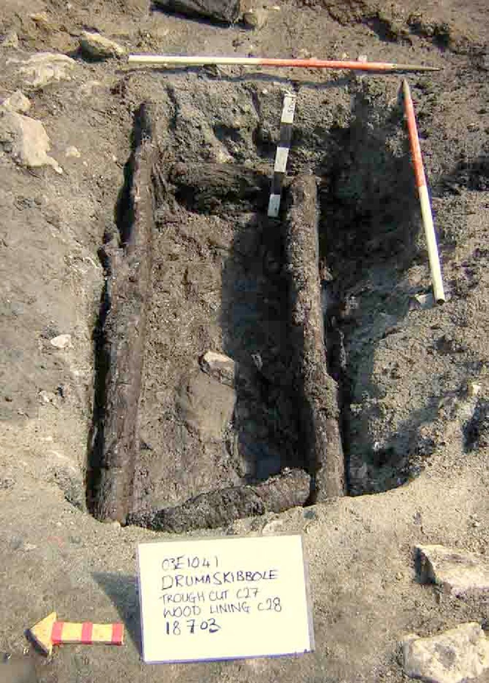
trough-2The base of the trough was uncovered at  a depth of about 0.3m below the surface. Four thick wooden planks (C28) were set, on their sides, into slots in the natural to form a rectangle, with the long axes orientated approximately WNW-ESE. The entire structure was roughly 1.8m long and 0.8m wide. There was no wooden base. At the WNW end, the end plank was held up by a wooden peg set into the natural. The planks were relatively thick ranging from 0.3m to 0.6m.

Compared to trough 1, this feature was relatively coarse, the planks were far thicker and rougher hewn and there was no base. As with trough 1 there was no evidence of any jointing, the sides being presumably propped and lined. The trough lay beneath the current water table as cut C27 was prone to filling naturally from the ground.
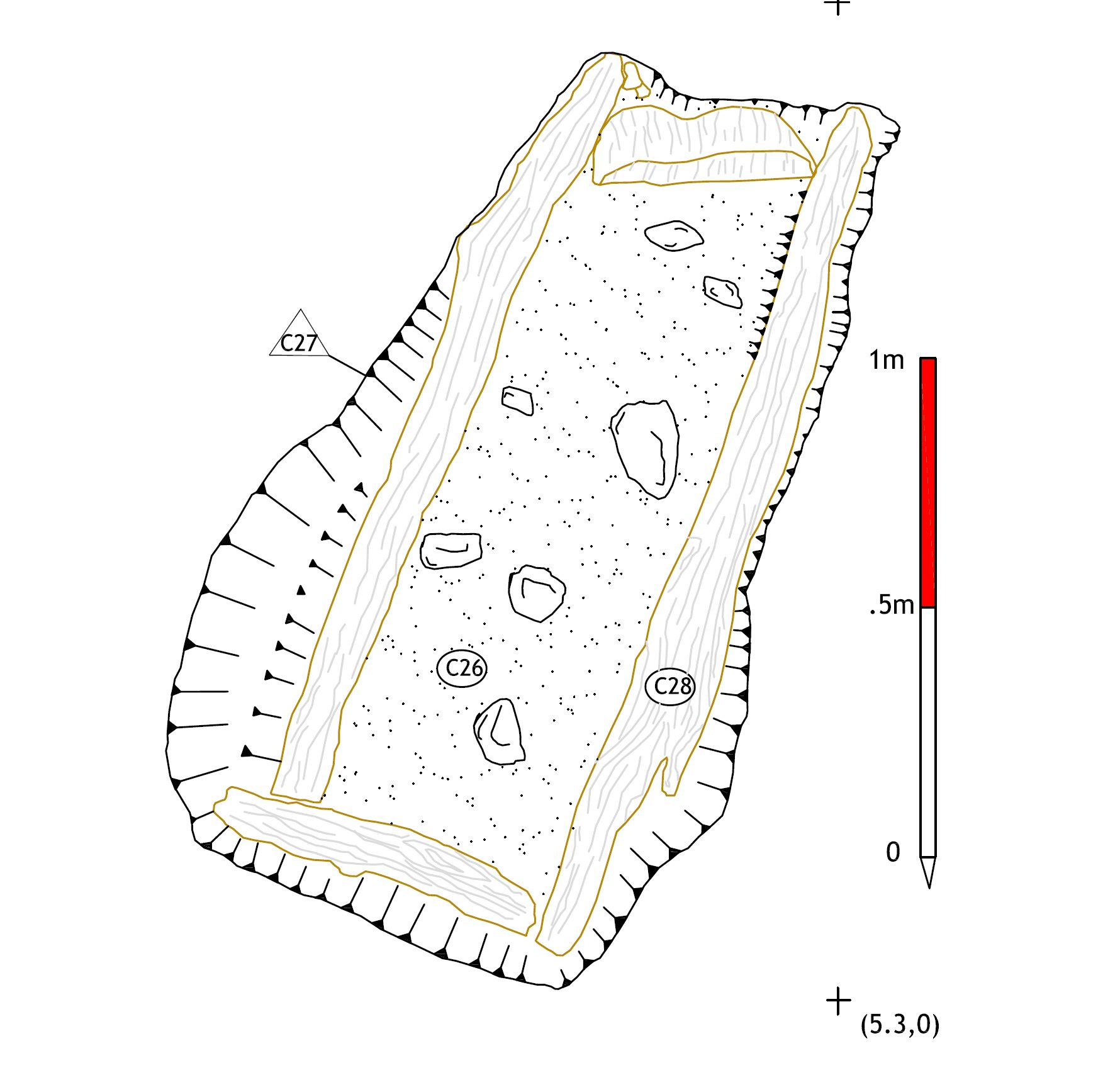
trough-21

Plank & Wattle Feature

During the last days of excavation an unusual feature appeared on the very northern edge of area 1 (7.80E/11.10N marked its southern tip). As the last of the peat below the fulacht was being removed a particularly dense concentration of wood was encountered. After more careful excavation and subsequent examination it was discovered that this wood was worked. This context, C39, consisted of three radially converted planks surviving as four elements. They measured: 1.24m x .20m (El#1) ; .69m x ..16m (El#2); .46m x .14m (El#3) ; .19m x .08m (El#4). These planks were laid in a semi-circular cut which sloped downwards from south to north. The base and walls of the cut were the natural white marl C45 and the planks followed the contour of the pit tongue and groove style.
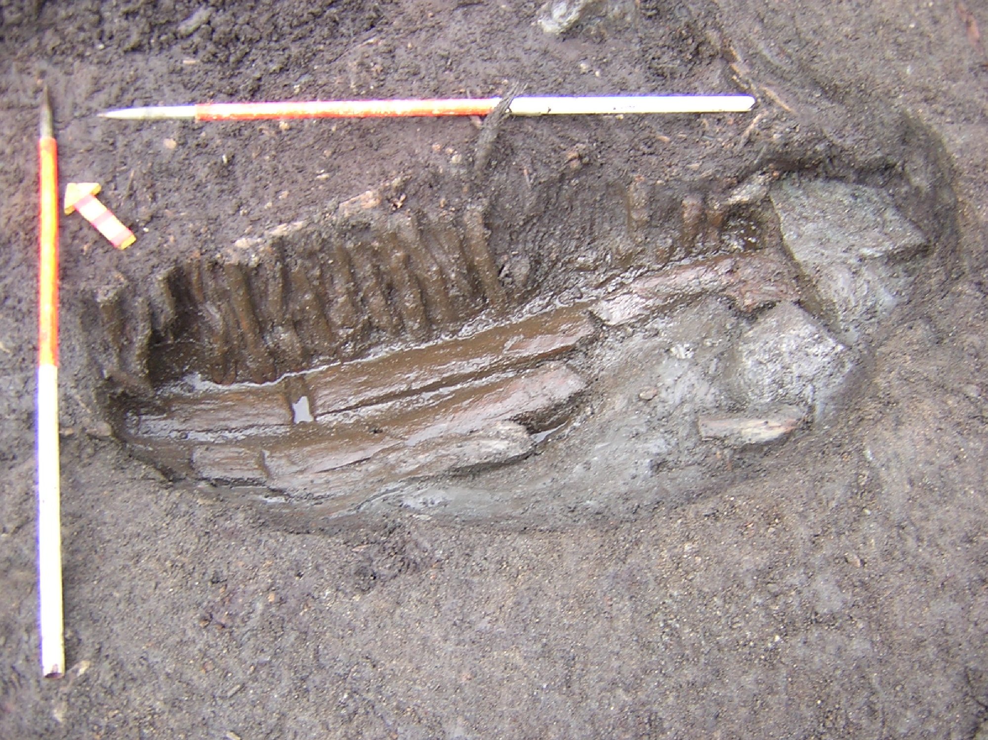
wattle

To the east of these planks, a row of contiguous hazel rods in an upright position (C38) seemed to mark the edge of the feature. These branchwood elements were of uniform size surviving to a height of 30cm and a median diameter of 3cm.The total length of this part of the feature was 1.14m. There was one longitudinal element woven through the top of the vertical rods. As an attempt at wattling this seemed at best perfunctory but it was actually all that was needed to secure the posts as they were driven into the space between element # 1 of C39 and element #5 in the next part of the feature to be uncovered, C41.

When the peat to north east of the hazel rods C38 was taken down it was discovered that the rods had not marked the end of the feature but rather served as an internal marker of some kind. Five unconverted roundwoods (C41) lay under the peat surviving as ten pieces. The largest of these (El#5) measured 1.3m x .20m. while the shortest(El#9) measured .34m x .19m. they were aligned in a SE/NW orientation in accord with the planks to the west. Although they were all broken only elements 8 and 9 at the northeast edge of the feature were in poor condition. These elements served to extend the feature into a sub-circular cut.
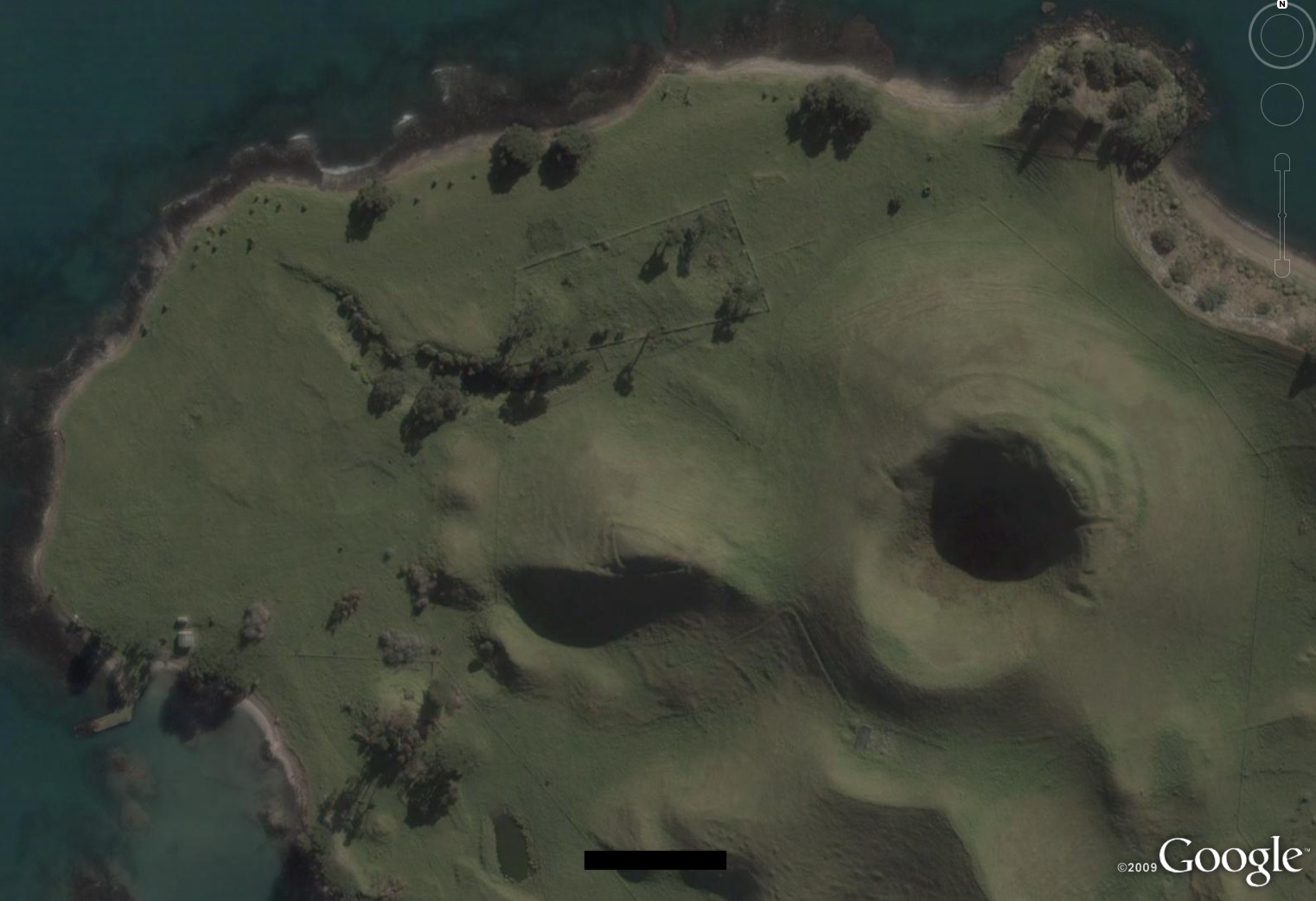
When on Google Earth 29

Q: What is When on Google Earth? A: It’s a game for archaeologists, or anybody else willing to have a go!

Q: How do you play it? A: Simple, you try to identify the site in the picture.

Q: Who wins? A: The first person to correctly identify the site, including its major period of occupation, wins the game.

Q: What does the winner get? A: The winner gets bragging rights and the chance to host the next When on Google Earth on his/her own blog!

Be the first to correctly identify the site below and its major period of occupation in the comments below and you can host your own! Like some of the other hosts, we’re not sure whether this one is really difficult or really easy!

woge29

WoGE so far:
A couple of the links below appear to be dead – if anyone can fill in the blanks leave a comment!

The game comes to us from our methodological cousins in geology. Shawn Graham adopted their game, and modified it for our use at whenonge #1.

Chuck Jones had the first correct answer, and then hosted whenonge #2. The winner never identified themselves so Chuck put up whenonge #2.1.

Paul Zimmerman got the correct answer to #2.1 and hosted whenonge # 3.

Heather Baker got the correct answer to #3 and hosted whenonge # 4.

Jason Ur won, and hosted whenonge # 5.

Dan Diffendale won that, and hosted whenonge #6 .

Claire at the Geevor Mine won #6 and hosted #7, which was won by Ivan Cangemi.

Ivan presented # 8 which was hosted at Tria Corda.

Moore Group hosted # 9 on behalf of Southie Sham.

That was won by Dan Diffendale who presented # 10.

WhenonGE # 11 was hosted by PhDiva which was identified by Daniel Pett.

Daniel hosted #12 at the Portable Antiquities Blog.

Neil Silberman won 12 and hosted 13 (link unavailable!).

Chuck Jones identified it and hosted # 14.

Aphaia/PhD in the Big Wide World put up WoGE 15 which was won by Daniel Pett.

We can’t find the link for no. 16….

Paul Barford hosted WhenonGE 17 at Portable Antiquity Collecting and Heritage Issues.

Scott McDonagh correctly identified 17 as Rosetta (Rashid) and presented us with the “City of 1000 Churches,” Ani.

Lindsay Allen hosted number 19.

Heather from Vienna won # 19 and presented When on Google Earth 20.

WoGE 20 was identified by the prolific Scott McDonagh.

Scott presented #21 which was won for the third time by Chuck Jones.

Chuck hosted # 22 at AWBG.

Paul Barford correctly identified the site as the amphitheatre of the military town of Aquincum (Budapest), Hungary and hosted WoGE 23.

Ferhan Sakal identifed WoGE 24 which had been hosted by Geoff Carter.

Ferhan hosted no. 25.

Lindsay won that one and subsequently gave us WoGE 26.

Woge 27 was hosted by Andrea and won by David Powell.

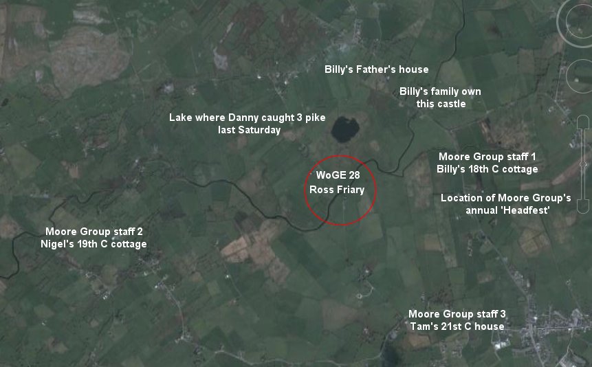
David Powell presented WoGE 28 which Moore Group’s Billy identified as Ross Abbey, which he overlooks from his cottage across the road… see below! Despite the fact that 3 staff members live within a 2 mile radius it still took us a while!

woge-28-notes

ICB Beer of the Year 2009

Congratulations to Aidan and Ronan at Galway Hooker on being awarded ICB Beer of the Year 2009.

From the Irish Craft Brewers website:

“Galway Hooker has featured in the ICB awards since their inception in 2007. This year it returns to its place as Ireland’s supreme champion, as voted by the drinkers. Members of Irish Craft Brewer recognise not only the superbly balanced flavour of Galway Hooker, and the incredible consistency with which it has been brewed by Aidan Murphy over the last four years, but also the steadfast work put in by Aidan and Ronan in distributing their beer across the country. There’s no point in making a high quality ale if no-one is able to drink it, and the 2009 Beer of the Year Award, voted on by members all around Ireland and beyond, is almost as much a recognition of the hard work that goes into getting Galway Hooker to the drinkers as it is to the excellent beer itself.”

The Tuam Martyrs, April 11, 1923

No matter what the future may hold for the Irish nation, the seven years — 1916 to 1923 — must ever remain a period of absorbing interest. Not for over two hundred years has there been such a period of intense and sustained effort to regain the national sovereignty and independence.”

DeValera

This weekend is a symbolically important one in Ireland, not least as it’s the commemorative weekend of the 1916 rising, but today (April 11th) also marks the 86th anniversary of the execution of the ‘Tuam Martyrs’ during the closing months of the Irish Civil War.

The Civil War began in June 1922 (although in April of the same year a group of 200 anti-Treaty Republicans had occupied the Four Courts in Dublin in defiance of the Provisional government). As with all civil wars, the conflict generated great bitterness and division, and has had long lasting political and social implications which have affected the Country right up to the present day.

In February 1923 Anti-Treatyite, Frank Cunnane, along with the other members of his unit were captured at Cluid, Headford, after a brief gunfight. One of Franks compatriots was killed while attempting to escape. The remaining men, including Frank, were marched to Galway.

On April 11, 1923, Frank, Michael Monaghan (also from Headford), Martin Moylan (from Annaghdown, Co. Galway) and John Maguire (from Cross, Co. Mayo) were executed in Tuam. Two further executions took place in Tuam on the same day – James (or John) Newell (from Galway) and James O’Malley (from Oughterard, Co. Galway).

One month later, on 24 May, 1923, Frank Aiken published the order of cease-fire and ordered the dumping of arms. De Valera also issued a statement to the Anti-Treaty army which said that:

“Further sacrifice on your part would be now in vain and continuance of the struggle in arms unwise in the national interest. Military victory must be allowed to rest for the moment with those who have destroyed the Republic.”

We’ve recounted the events which led to the executions of the men in a little more detail in an earlier blog post here. That earlier post was instigated by the discovery of a letter sent by Frank Cunnane to his mother on the eve of his execution which had been taped to the back of a shelving unit in a friend’s house in Headford. As a result of that post, we received correspondence from several relatives of Frank’s as well as other interested parties.

One of our readers, Alison Larkin, came across our blog while researching some mass cards she found among her Grandmothers things. She very kindly forwarded us copies of the series of Cards which relate to the Tuam Martyrs and others and which we have posted below to mark the anniversary of the executions. She theorizes that her grandmother may have been involved personally with one or was affiliated somehow with all of these men during the War of Independence – a relationship which landed her in jail without a trial after the Treaty, when the country was divided.  She was about 18 years old when she was imprisoned.

Her grandmother was still a prisoner at Kilmainham when some of these men were executed.  Alison thinks that she may have received some of the cards in a parcel as word that the executions had happened.  Either that, or she attended mass for them when she got out.  From what Alison can tell it was probably something that was grieved on in private and not at a public mass.

These individual items, small mementos of a deeply traumatic time in Ireland, put our current economic woes in perspective. The fact that Alison’s Grandmother treasured and kept the cards hints at the deep admiration she had for these men and the sacrifice they made. The deep rifts in our communities and families that remained after the Civil War and the pain the war inflicted imbue these objects with a deeper significance.

(more…)