Blog
Via the Marine Institute: A new and improved version of the European Atlas of the Seas is now available on the website of DG Maritime Affairs and Fisheries: http://ec.europa.eu/maritimeatlas It includes 24 new maps ETC… New maps include:
- Natura 2000 protected maritime sites
- Pollution response vessels
- Coastal GDP
The atlas is an easy way for students, professionals and anyone interested to learn more about Europe’s seas and coasts, their environment, related human activities and European policies…
Available here: http://ec.europa.eu/maritimeatlas
Background
The European Atlas of the Seas was one of the actions outlined by the Commission when it launched an Integrated Maritime Policy for the European Union in 2007. A pilot version of the atlas has been available on DG Maritime Affairs and Fisheries’ public website since May 2010. The new version takes into account the feedback received on the pilot version from the public survey and user testing.
Link to the Maritime Atlas
http://ec.europa.eu/maritimeatlas
May 09, 2011 | Categories:About Environment, About Marine, News | Tags: Coastal GDP, environmental consultants galway, European Atlas of the Seas, Maps, natura 2000 | Leave A Comment »
From the Heritage Council:
‘The final version of the Heritage Council’s Best Practice Guidance for Habitat Survey and Mapping is now available on our website at www.heritagecouncil.ie
This publication presents current best practice guidance for survey and mapping of habitats in the Republic of Ireland, and is aimed primarily at those who conduct or commission habitat surveys. Its objective is to standardise and improve habitat survey and mapping methods in order to achieve compatability among surveys and surveyors, and to ensure the quality and consistency of the maps and data produced.
The Heritage Council would like to take this opportunity to thank all those involved in the preparation of the document, the authors, the Steering Group members from NPWS and Cork County Council, the editor, and all those who responded to the consultation process and participated in the peer review.
Please note that this publication is only available as a pdf that can be downloaded from our website, or read online; hard copies are not being made available, due to resource constraints.’
May 05, 2011 | Categories:About Environment, News | Tags: Ecology, environmental assessment, Habitat Mapping, Habitat Survey, Heritage Council, Ireland | Leave A Comment »
Via WAC:
The Day of Archaeology 2011 is an online project that will allow archaeologists, professional and volunteers, working all over the world to document what they do on one day, July 29th 2011. Archaeologists taking part in the project will document their day through photographs, videos and written blog posts. These will then be collected on the website (http://www.dayofarchaeology.com/ ), which will provide a glimpse into a day in the life of people working and volunteering in all areas of archaeology, from archaeological excavations to laboratories, universities, community archaeology groups, education services, museums and offices.
This project is open to everyone working or volunteering in any aspect of archaeology from anywhere in the world, is completely free to join, and is organised and managed by a team of UK-based volunteers, with participants registered from every continent. We are very happy to support people who wish to participate but do not have access to, or feel comfortable using, digital technologies, and can assist with uploading images, text etc.
We are actively seeking more partcipants and would love you to join us!
For more details, please visit our website:
http://www.dayofarchaeology.com/about-the-project/
Apr 28, 2011 | Categories:About Archaeology, Latest News, News | Tags: Day of Archaeology | Leave A Comment »
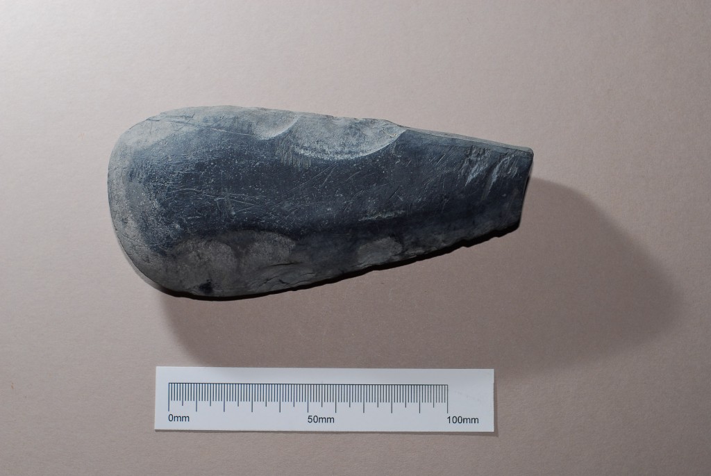
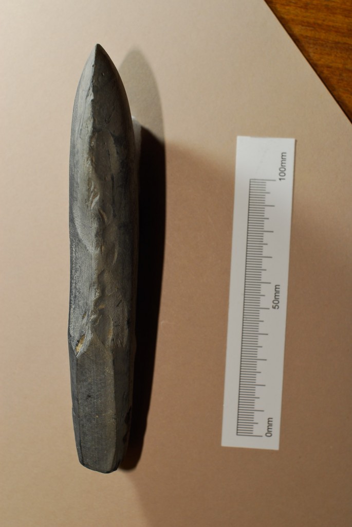
Here’s another find – this one’s from 2009 and was recovered during monitoring of excavation works for a park and ride facility at NUI, Galway. Archaeological monitoring at the development site exposed no features of archaeological significance. However the stray find of a Neolithic polished stone axehead recovered from up-cast material from a service trench to the South West attests to the previous activity. The numerous finds ranging in date from the Prehistoric period to Medieval times recovered from within and along the banks of the River Corrib demonstrate the importance of the river as a navigable route providing access to the islands of Lough Corrib and the surrounding hinterland. Moreover the finds location to the north of a known fording point at Jordans Island indicates the strategic importance of this general area.

The river Corrib has been described as a short river with a long history. The river drains Lough Corrib, the largest lake in Ireland, and flows south-eastwards for a distance of 6km to the sea. The river was forded rather than being crossed by boat below Menlough Castle in prehistoric times. The river was also forded at Jordan’s island from Viking days and at the site of the Salmon Weir Bridge from medieval times (Spellissy 1997, 91). An area south of Menlough near the graveyard, known locally as ‘the Tail of the Woods’, has produced much evidence of early human activity in the area. Hundreds of stone implements dating from the late Mesolithic and the early Neolithic have been found in the river Corrib and on its banks in the area between Terryland castle and Menlough castle. The finds included various types of blades, as well as Bann flakes, hammer stones, and axe heads. Evidently, the river Corrib was an important resource for inhabitants of the area during the Mesolithic and Neolithic, which provided plentiful fishing, foraging and hunting. There is some evidence for ritual deposition in the River Corrib during the Bronze Age. During the 1980’s, three bronze spear heads were found in a deep section of the river, opposite the entrance to the lakes of Coolough. They were found close together which suggests that they were possibly votive offerings, (ibid. 56). During the Iron Age and the early historic period, the area continued to be prime settlement area, evidenced by the ringforts and cashels, which were built on the banks of the Corrib River. A La Tene sword was also found near Jordan’s Island, a sign of Iron Age activity in the general area. Viking type swords have also been found near Jordan’s Island. The annals record that Vikings plundered the islands of Lough Corrib in 927 AD, presumably by navigating the River Corrib at full tide. Another reference in the Annals is to the Earl of Thomond crossing the fording point at Jordan’s Island in 1560 AD.

Reference: Spellissy, S., 1997. The History of Galway.
Apr 15, 2011 | Categories:About Archaeology, Finds, Virtual Museum | Tags: Archaeologist, Artefacts, axe, finds, galway, neolithic, polished stone axehead | 1 Comment »
And on an unrelated note, this just in from the ESAI – The Fourteenth Meeting of the Irish Environmental History Network will feature a talk by Dr. Kieran Hickey of the Department of Geography, National University of Ireland, Galway.
The is entitled “Wolves in Ireland: A Natural and Cultural History”, and a short abstract may be found below.
This talk will assess the evidence for wolves in Ireland using a variety of sources including archaeological, placenames, folklore and documentary information. It will be shown that wolves were a deep part of Ireland’s cultural history mostly forgotten and that they were a major component of the Irish landscape long before humans arrived and right up to 1786 when the last wild one was most likely killed. An assessment of wolf numbers will be presented based on a variety of evidence and the cause of their demise will also be outlined. The case for re-introduction will also be discussed.
The meeting will take place from 5pm, this Thursday 14 April, 2011, in Room 3051, Floor 3, Arts Block, Trinity College Dublin.
Attendance is free, and all are welcome.
Please spread word of this event to anyone you feel may be interested.
http://www.tcd.ie/longroomhub/iehn/
Apr 11, 2011 | Categories:News | Tags: Ireland, Wolves | Leave A Comment »


