Cahercommaun Fort, Co. Clare
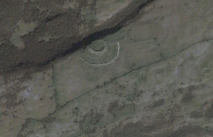
We selected Cahercommaun Fort for WhenonGE 80 which was identified by Brian Dolan at Seandálaiocht. So here’s a little more info on the site. The fort is well known and is an inland cliff-top fort in state ownership. It comprises a roughly circular stone enclosure perched on a cliff edge with two concentric outer enclosing walls. A well-defined passageway gives access through the outer enclosure to the centre enclosure on the eastern side of the fort and traces of radial walls and other ephemeral features can be seen between the enclosing walls and in the surrounding fields.
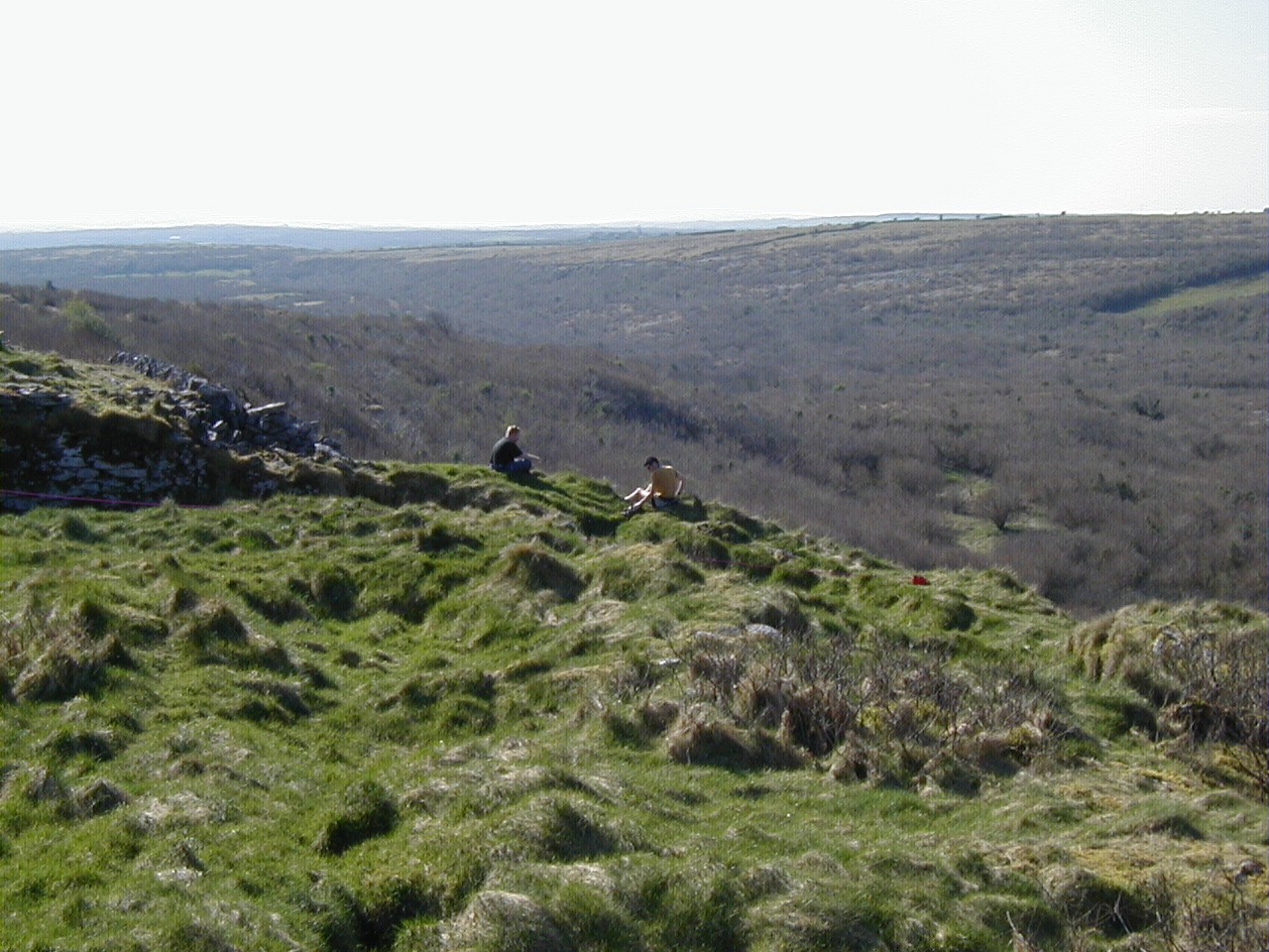
Cahercommaun is situated in the Burren region of County Clare. The distinctive Karst geology here consists of great expanses of bare rock and relatively smooth slopes which are the result of intense erosion of loose rocks and other debris by glacial ice which crossed Galway Bay and then over-rode the Burren plateau. Parallel to the direction of ice movement, the effects of glacial erosion have emphasised pre-existing landforms such as the cliffs, cols and terraces that characterise the immediate area surrounding Cahercommaun fort.

Cahercommaun from Google Earth
The Burren is well known for its Karst scenery and unusual flora and has long been a place of pilgrimage for naturalists. Pollen analyses have shown that there was a complete cover of pine with subsidiary hazel and yew on the Burren during the Boreal and Atlantic periods. Today woodland is rare but patches of hazel are fairly widespread. The numerous parallel fissures dissecting the soil-free limestone pavement harbour an abundant and diverse flora consisting mostly of fragmentary patches of limestone grassland or a woodland ground flora.
Cahercommaun is sited at the north western edge of the extensive plateau of Tullycommon/Glaseivagh Hill, an area providing the best winter grazing for cattle in the whole of the Burren. In the immediate vicinity of the fort, the narrow side of the plateau drops steeply to a narrow gorge about 30m below. The stone fort of Caislean Gearr (SMR CL010:057) stands on a rock pinnacle at the entrance to this gorge. The Plateau itself is dotted with archaeological sites, over twenty cashels or enclosures have been recorded, as well as four wedge tombs, a cist grave and a number of prominently sited cairns.

Cahercommaun
Cahercommaun fort (Cathair Chommáin or Chumainn) is situated in Tullycommon townland (Tulach Chommáin orChumainn). According to Edel Bhreathnach both placenames may retain in their second element the personal names Commáin or Cumann (Bhreathnach, 1999, 90). They can thus be translated as the fort of Commáin or Cumann and the hill of Commáin or Cumann.
“It is plausible to suggest, however, given what is known of the polity of this region from the 7th century onwards that the fort was constructed either by a branch of the Ciarriage, to whom Cumann mac Dega belonged, or more probably by the Uí Chormaic, the segment of the Uí Fidgeinti to whom Commán mac Mainich was affiliated. The Uí Fidigeinti case is stronger, considering that their authority from the Shannon Estuary to the Aran Islands in the 7th and 8th centuries was solid enough to cause the construction of a fort of the dimensions of Cahercommaun”.
Moore Group undertook a project at Cahercommaun on behalf of the Department in 2003. The project involved the removal by hand of stone collapse lying south of the outer enclosure wall to enable repair works to be carried out the breaches in the wall in advance of construction of a proposed boardwalk.
Access to the site is granted by a well defined track from the road to the field boundary to the east of the fort.
Six cuttings concentrating on areas of rubble collapse were manually cleared of overgrowth and recorded. The stone collapse was than half sectioned, where possible, and finally removed to designated spoil areas exposing the original surface level. All the stone collapse corresponded to areas where the outer enclosure wall had been breached or degraded. No finds were retrieved from the collapse. However, a stone feature, possibly a hut site or animal pen, was exposed to the west of trench 1. This feature abutted both the outer enclosure all and an early field boundary.
Our trench 1 was located to the east of a junction point of a field boundary with the outer enclosure wall and was the westernmost of all the cuttings. The trench originally measured 11.5 m by 3 m but was later extended to the east following on-site discussions with Dr. Ann Lynch.

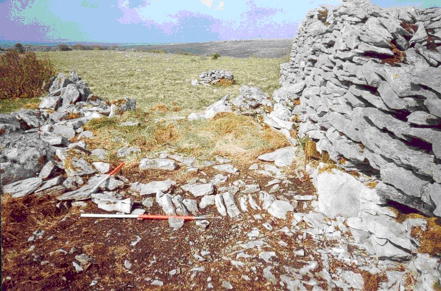
Possible hut site, Cahercommaun
At the western terminal of the trench a curvilinear stone feature was identified running south from the outer enclosure wall towards a field wall orientated north south. This feature consisted of a number of foundation stones set on edge and laid regularly in a row. The alignment of these stones corresponded to a large stone jutting out from the base of the outer enclosure wall. Although the investigation of the feature was limited by the constraints of the trench it was possible to follow its line as it curved to the west past a point where it abutted the field wall and back towards the outer enclosure wall where it disappeared under overgrowth and rubble collapse. The feature may well be a hut site or small animal pen similar to those found within the fort.
In the exposed cutting, the stone foundation measured 3m north south and had a width of approximately 0.32 m. internally there was a number of inset stones that may have formed a floor level. Further investigative work on the feature lay outside the scope of our archaeological brief; the exposed stones were recorded, photographed and left in situ.
Cotter, C., 1999. Western Stone Forts Project, Cahercommaun Fort, Co. Clare; a reassessment of its cultural context. In Discovery Programme Reports 5. Dublin.
This entry was posted on Friday, February 19th, 2010 at 11:58 am. It is filed under About Archaeology and tagged with Cahercommaun, Clare, Inland promontory, irish archaeology.
You can follow any responses to this entry through the RSS 2.0 feed.


